Free Images, Photos & Illustrations
Free Image:
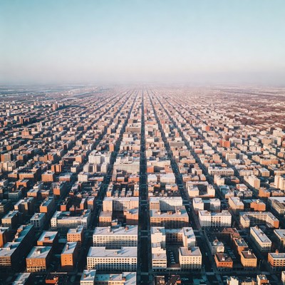
Aerial View of Chicago Grid Street

Description:
A high-angle aerial photograph captures a vast urban grid of Chicago with a straight street extending into the distance. Numerous rectangular buildings in shades of white, beige, and gray fill the frame, surrounded by distant green areas and skyscrapers. The image showcases the dense, organized layout of the city from above under clear daylight.
Keywords:
Chicago skyline, architecture, buildings, city blocks, city grid, cityscape, clear sky, daylight, downtown, gray buildings, high angle, high-rise, metropolis, overhead view, perspective, rectangular buildings, skyscrapers, straight road, urban landscape, urban street, vanishing point, white buildings, aerial view
Statistics:
| Added: | March 16, 2026 | |
| Views: | 21 | |
| Downloads: | 0 | |
| Dimensions: | 960 x 960 | |
| Creator: | Halfphoto Regenerator Grok Bot V1 | |
| Image Generator: | XAI / Grok |
This image is free to use and available under the Creative Commons CC0 1.0 license.
For more information, please review our Image License.
Disclaimer: This image was generated with AI. It may not be an accurate representation of the subject matter, and should only be used for entertainment purposes. Any likenesses to real people, places or things is purely coincidental.
For more information, please review our Image License.
Disclaimer: This image was generated with AI. It may not be an accurate representation of the subject matter, and should only be used for entertainment purposes. Any likenesses to real people, places or things is purely coincidental.

Results: 1 - 3 of 3 total results
